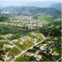
Conservation Subdivision Program

The intent of the Conservation Subdivision Program (CSP) is to encourage residential subdivision design that improves the preservation of sensitive environmental resources and community character. Conservation subdivision design results in numerous benefits, including the preservation of local biodiversity, retention of existing agriculture/farmland, increased watershed protection, improved recreational opportunities, reduced infrastructure costs, and improved fire protection for residential developments. This program is mandatory when subdividing property with General Plan residential land use designations of Semi-Rural 10 and Rural Lands 20, 40 & 80.
The CSP is being implemented through changes to the Zoning Ordinance, Subdivision Ordinance, and Resource Protection Ordinance. These changes are intended to better support conservation oriented design and remove existing obstacles that discourage or preclude it while maintaining appropriate checks and balances to protect communities. It is important to note that projects proposed under the Conservation Subdivision Program will not be allowed by-right, and consequently will require discretionary review necessitating that findings be made to assure project compatibility.
Subdivision Design — Additional design requirements have been added to the Subdivision Ordinance for all subdivisions in rural lands to further encourage conservation oriented design. The design requirements address both the project design and design and preservation of open space and sensitive resources.
Applicable Subdivision Ordinance Sections:
Section 81.308(a)(6): Waiver or Modification of Regulations
Section 81.401(r): Protection of Sensitive Resources
Table 81.401.1: Requirements to Protect Sensitive Resources
Designation | Minimum Percent Avoided Resources |
SR-10 | 75 |
RL-20 | 80 |
RL-40 | 85 |
RL-80 | 90 |
Rural Subdivision Design and Processing Guidelines were created to assist property owners, designers, engineers, developers and others involved with the subdivision of rural land in the unincorporated County of San Diego. The document provides guidance on how to study, design, and process a rural subdivision that is in compliance with the County’s policies and procedures.
Reducing Lot Design Restrictions — There are a number of County regulations that relate to lot size and dimension, and limit the ability to provide compact or non-uniform designs that respond to site constraints and characteristics. The following regulations are aimed at reducing lot design requirements for conservation subdivisions.
- Minimum Lot Size — Minimum lot size in zoning has been decoupled from the density regulations in the General Plan; meaning that a minimum lot size in zoning does not dictate the number of permitted dwellings. Rather the General Plan land use designation identifies the maximum number of permitted dwelling units allowed.
Applicable Zoning Ordinance Sections:
Section 6621: Computation of Permitted Number of Lots
Section 6624: Lot Size
Section 4100: Density Regulations
Section 4200: Lot Area Regulations
- Use of Waivers: — To improve the ability to use waivers when appropriate, the waiver language in the Subdivision Ordinance was modified to allow for waivers of the regulations that do not meet the goals of the Conservation Subdivision Program.
Applicable Subdivision Ordinance Sections:
Section 81.308(a)(6): Waiver or Modification of Regulations
Section 81.614(a)(1)(F): Modification of Regulations
- Resource Protection Ordinance — Updated the ordinance to allow additional encroachment within steep slopes when projects sufficiently conserve other sensitive lands and meet preserve design guidelines. Additionally, slope-based density calculations were removed to reduce redundancy and potential conflicts with the General Plan Land Use Element.
Applicable Resource Protection Ordinance Sections:
Section 86.604(e)(1): Permitted Uses and Development Criteria - Steep Slope Lands: Density Formula
Section 86.604(e)(2)(cc): Permitted Uses and Development Criteria - Steep Slope Lands: Project Design and Open Space to Protect Steep Slopes
OTHER TOOLS
Planned Residential Developments (PRD) — PRDs allow for reductions in lot size and other design restrictions when a certain percentage of open space is provided. To ensure that PRDs do not result in undesirable impacts to environmental resources and community character, findings must be made. To promote PRDs, the County has:
- Refined the requirement for “higher level of amenities” as being more applicable to village developments and less applicable to rural developments.
- Revised usable open space requirements so they are more realistic and allow for substitution of group usable open space if private open space cannot satisfy the requirement.
- Revised non-usable open space requirements so they are more applicable to resource preservation and provide a gradation of required open space depending on residential land use designation.
Applicable Zoning Ordinance Sections:
Section 5800: Planned Development Area Regulations
Section 6600: Planned Development Standards
Section 6648: Open Space
Lot Area Averaging — With appropriate findings, lot area averaging allows for flexibility in lot sizes provided the overall density is maintained. The Zoning Ordinance requirement that perimeter lots match the size and shape of neighboring lots has been eliminated and instead the ordinance requires compatibility and buffering where necessary.
Applicable Zoning Ordinance Section:
Section 4230: Lot Area Averaging/ Conservation Subdivision
LINKS:
Rural
Subdivision Processing and Design Guidelines


